

Digitized towers for a network with greater control
Inspection with professional drones (UAV), digital twins, geospatial intelligence, and automated inventory for asset management, available space, and structural condition assessment — with no human risk.
structures audited
of capture per tower
human exposure at height
3–5 days
Pixel Tower addresses the main challenges of asset control, detailed engineering, safety, and maintenance in telecommunications infrastructure, combining drone inspection, digital twins, artificial intelligence, ArcGIS, and georeferenced data.


Asset Inspections
High-resolution visual inspection to assess the structural condition of towers, antennas, and accessories, reducing risk and optimizing inspection times. We generate the photographic and metric record your legal and procurement team needs.
- Greater operational safety.
- Access to complex areas.
- Digital record of asset condition.
- Information for maintenance and engineering.
- Continuous operations through hot inspections.
Digital Twins and As-Built Models
We generate point clouds and 3D tower models. We verify antenna orientation (actual vs. designed azimuth and tilt), detect corrosion and structural fatigue, and generate automatic As-Built drawings in DXF/DWG format.
- Fewer site visits.
- 1–2 mm structural accuracy.
- Technical delivery in 3–5 business days.
- Compatibility with ArcGIS, Navisworks, AutoCAD, and BIM.
AI-Automated Inventory
We automatically detect and classify antennas, RRUs, radios, microwave dishes, and other components to generate georeferenced digital inventories for.
- Technical Site Audits (TSA).
- Technical Site Survey (TSS).
- No manual counting.
- No human error.
360° Line-of-Sight Studies
Collection of geospatial data and high-definition 360° spherical imagery to analyze line-of-sight between nodes, plan network expansions, and assess the feasibility of new sites.
- Reduction in field visits.
- Elimination of blind spots.
- Access to complex areas.
- Proof of feasibility for clients and regulators.
Data and deliverables for network management
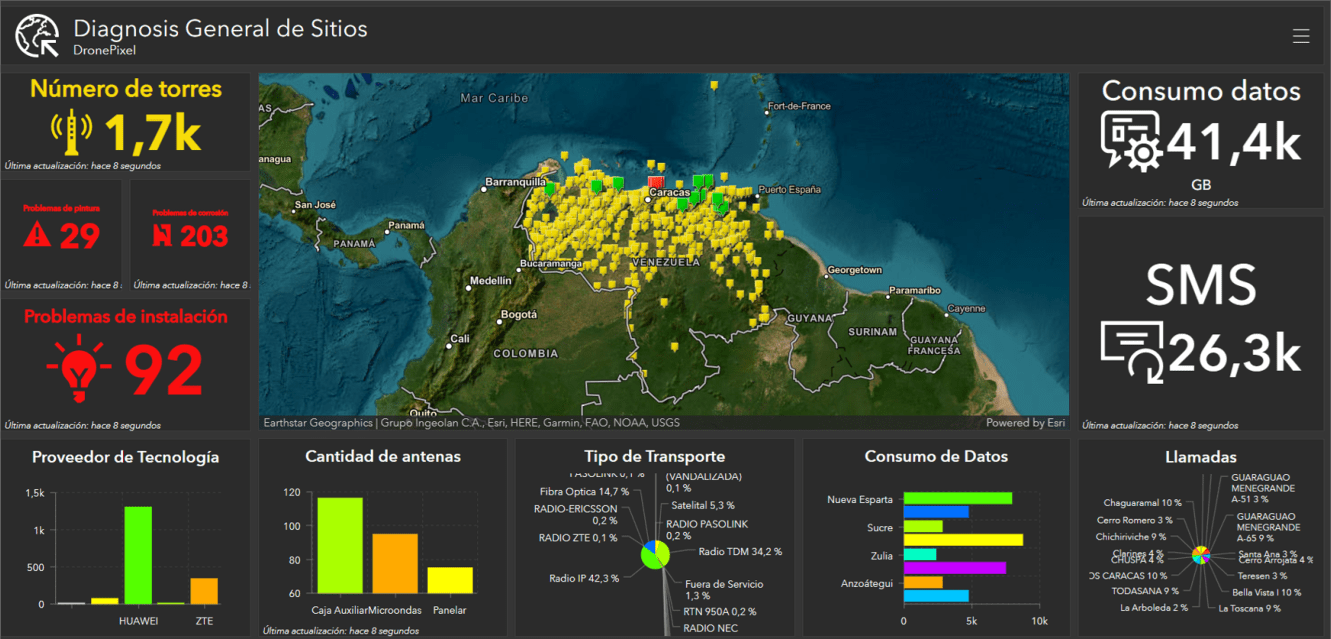
Every digitized site brings together the visual, technical, and analytical information needed to audit infrastructure and coordinate decisions across engineering, operations, finance, and maintenance departments.
Platforms and virtual environments
- Centralized cloud portal built on AWS and ArcGIS.
- Digital technical data sheet per site.
- Immersive 360° virtual tour.
- 3D viewer for measurements, annotations, and simulations.
Native engineering files
- Digital twin and point cloud in .LAS, .LAZ, .OBJ.
- As-Built drawings in .DWG and .DXF.
- Tower elevation, plan view, and site details.
- Offset, azimuth, and tilt calculations.
Analytical reports and business intelligence
- Analytical asset inventory (AI Inventory Report).
- AI-automated anomaly report (Defect Pin Annotations).
- Available space report (Space Availability Report).
Precise data and geospatial information for better decision-making

Tower and colocation auditing
Verification of available space and structural conditions to support tenancy contracts between operators.
Digital tower inspection
Centralized data in ArcGIS to plan 5G deployment and optimize coverage nationwide.