

Precise data and geospatial information for better decision-making
Transform the way you inspect and manage your assets. We integrate drones, LiDAR, SLAM, and native platforms in Esri ArcGIS to deliver fast, reliable information.
Integrating UAV/drones into technical inspection, geospatial data capture, and data processing for industrial and engineering projects.
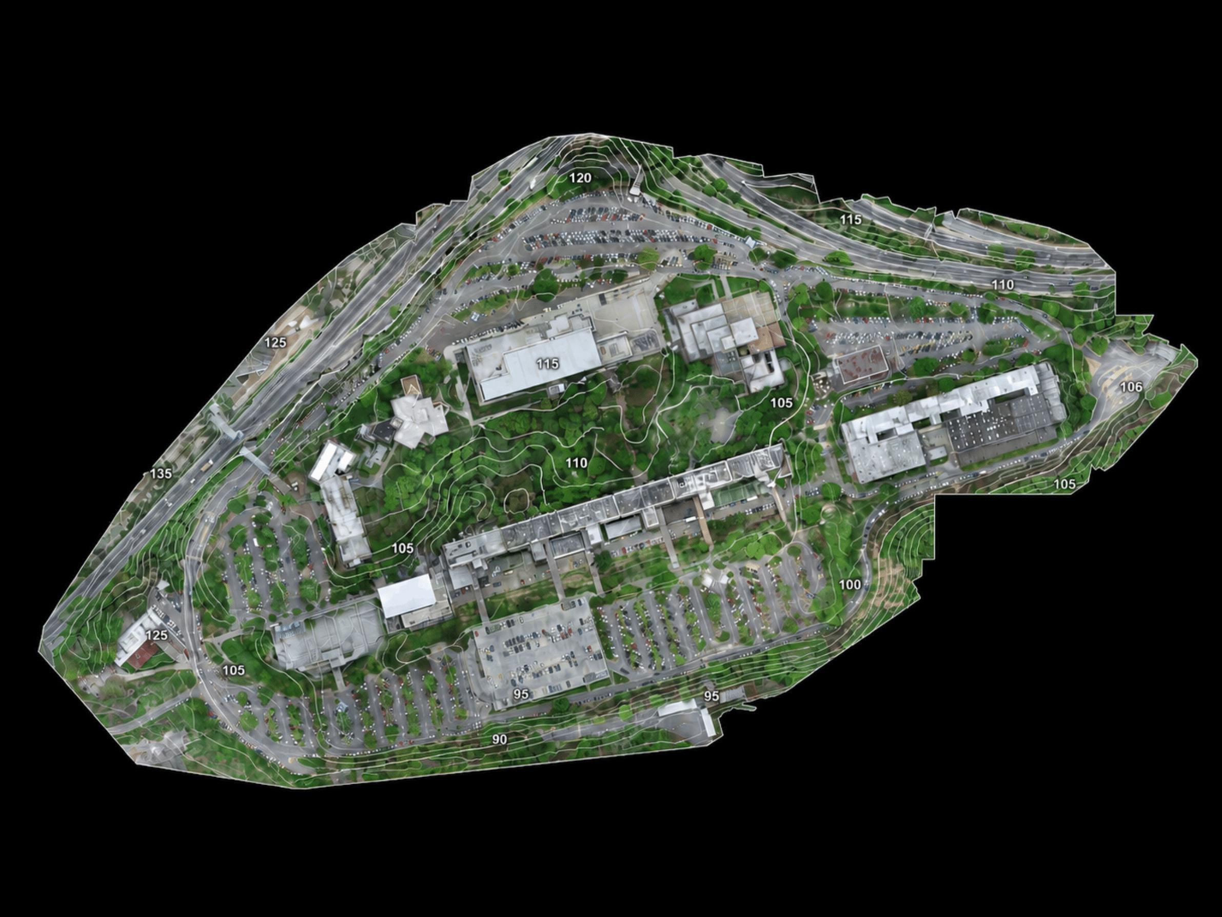
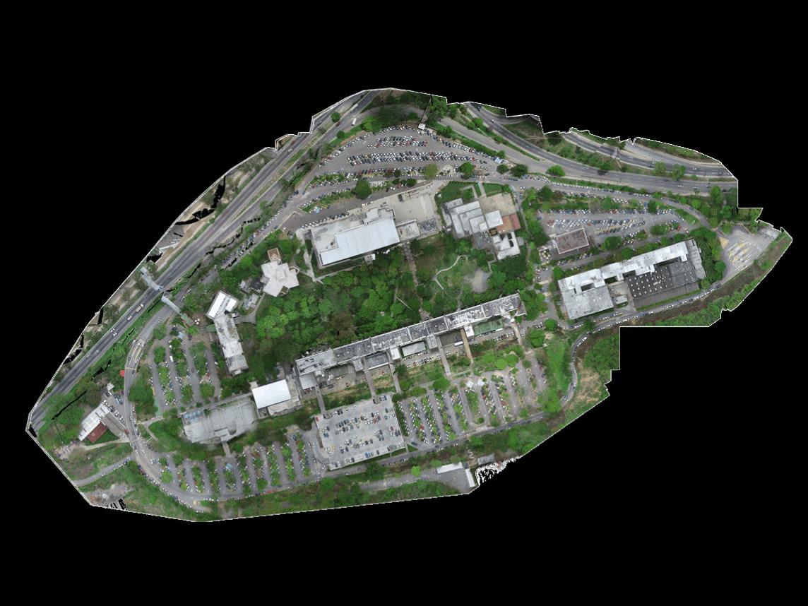
We generate high-precision point clouds and orthomosaics across complex or hard-to-reach terrain, optimizing time and resources.
Digital twins and thermal/visual inspection of power lines, telecom towers, and industrial plants for asset inventory, structural analysis, and engineering support.
From data capture to better decisions
We go beyond drones: we combine data engineering, advanced sensors, and the Esri ArcGIS ecosystem to turn complex physical assets into accurate, traceable, and accessible technical information.
Native GIS integration
We process and centralize all your data directly within the Esri ArcGIS ecosystem. Your asset information — accessible from anywhere, ready for GIS, BIM, and CAD workflows, and linked to geodetic networks.
Less downtime
Hot inspections without stopping operations. We cut field time by up to 60% and logistics costs by 35% compared to conventional methods.
Digital Twins
We integrate aerial LiDAR and terrestrial SLAM to generate digital twins with no blind spots. Precise point clouds for engineering, maintenance, and BIM workflows (Revit, Navisworks, AutoCAD).
Maximum field safety
We eliminate 99% of human exposure at height, in confined spaces, and in high-risk zones. We specialize in vertical structure inspection. The drone goes first, always.
Five geospatial
engineering capabilities
Integramos LiDAR aéreo y SLAM terrestre para generar gemelos digitales: interior y exterior, sin puntos ciegos. Nubes de puntos de alta densidad (.LAS, .LAZ, .OBJ) y modelos As-Built a escala milimétrica, entregados como capa nativa en ArcGIS o en formatos BIM listos para Revit, AutoCAD y Navisworks.
Context Digitization and Digital Twins / 3D Laser Scanning
We integrate aerial LiDAR and terrestrial SLAM to generate digital twins — interior and exterior, with no blind spots. High-density point clouds (.LAS, .LAZ, .OBJ) and millimeter-scale As-Built models, delivered as a native ArcGIS layer or in BIM formats ready for Revit, AutoCAD, and Navisworks.
Asset Inspection
We specialize in vertical structure inspection: telecom towers, flare stacks, transmission lines, tanks, and substations. We combine RGB visual inspection, radiometric thermography, and gas detection (OGI/TDLAS) to audit assets while hot — without stopping operations and without exposing personnel at height. Every finding is georeferenced and integrated into ArcGIS for predictive maintenance.
Topography, Geomatics, and Terrain Modeling
Surveys linked to geodetic networks with centimeter-level (RTK) precision, generating DTM, DSM, georeferenced orthomosaics, and contour lines — exportable directly to AutoCAD, Revit, and ArcGIS. From 4 hours down to 20 minutes of capture per 50 hectares.
Interactive Virtual Tours
High-definition 360° walkthroughs linked to ArcGIS maps, technical drawings, and information points with metadata. Remote facility monitoring, HSE audits, and plant inspection without sending personnel on-site.
Training and Consulting
We enable corporations to build their own internal UAV operation teams. Advanced technical training and ArcGIS workflow coaching to integrate geospatial capture into your organization’s internal processes with full autonomy.